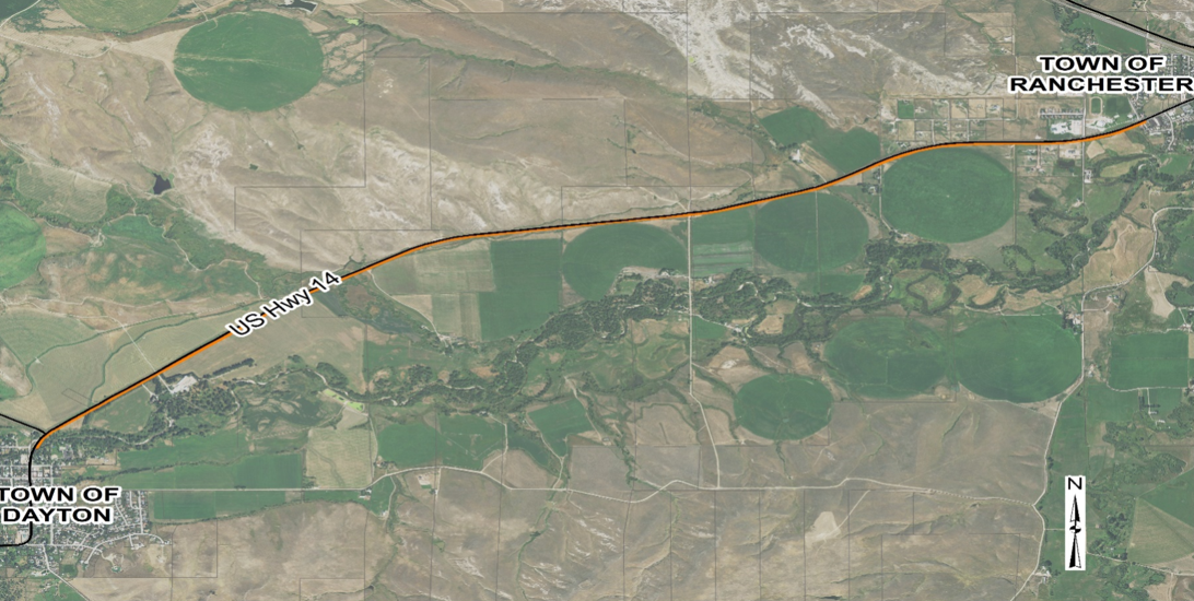
In 2020, the Town of Ranchester and the TR Path Committee contracted WWC Engineering (WWC) to study the feasibility of constructing a pathway to connect the communities of Dayton and Ranchester. This study will provide the committee with alignment analysis, design and regulatory constraints, anticipated permitting requirements, a preferred conceptual alignment with cost estimates, and project funding opportunities.

Project Contacts
- Ranchester Engineer:
Will Newbold
(307) 655-2283
- WWC Project Manager:
Cody Wyatt
(307) 672-0761
[email protected]
Project History
As early as 2005, interested community members began exploring the possibility of developing a pathway to connect the communities of Ranchester and Dayton.
In 2018, TRVCC Executive Director Erin Kilbride, Mayor Peter Clark of Ranchester, and Brad Bauer with Sheridan Community Land Trust (SCLT) attended a pathway conference in Colorado to learn more about pathway construction and funding. In December of that year, the SCLT applied for and received a grant from the National Park Service (NPS) Rivers, Trails, and Conservation Assistance Program to help with the Tongue River Pathway project. The grant provided a NPS employee to assist with the planning stages of the project.
The Town of Ranchester, Town of Dayton, and the TRVCC subsequently formed the Tongue River (TR) Path Committee to guide the planning process. The Committee conducted a community survey and held two community meetings to discuss the walking path. Another meeting was held with WYDOT, the Town of Ranchester, the Town of Dayton, and other key stakeholders. In July 2019, the Town of Ranchester applied for and matched a WYDOT Transportation Alternatives Programs (TAP) grant, with Sheridan County and the Town of Dayton each providing an equal share of the $25,000 match. In December of 2019, the TR Path Committee was awarded the TAP grant that is funding this feasibility study.
Project Benefits
- Safer travel route between communities for pedestrians and bicyclists
- Alternative to motorized travel between communities
- Recreational asset usable by locals and tourists
most of the year - Economic benefits in the form of outdoor recreation opportunities without having to leave the TR Valley
- Wildlife viewing opportunities
(Click images to enlarge)
Potential Alignments
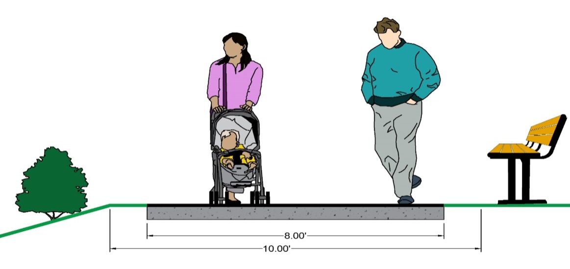
Proposed Cross Section
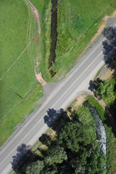
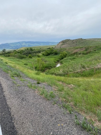
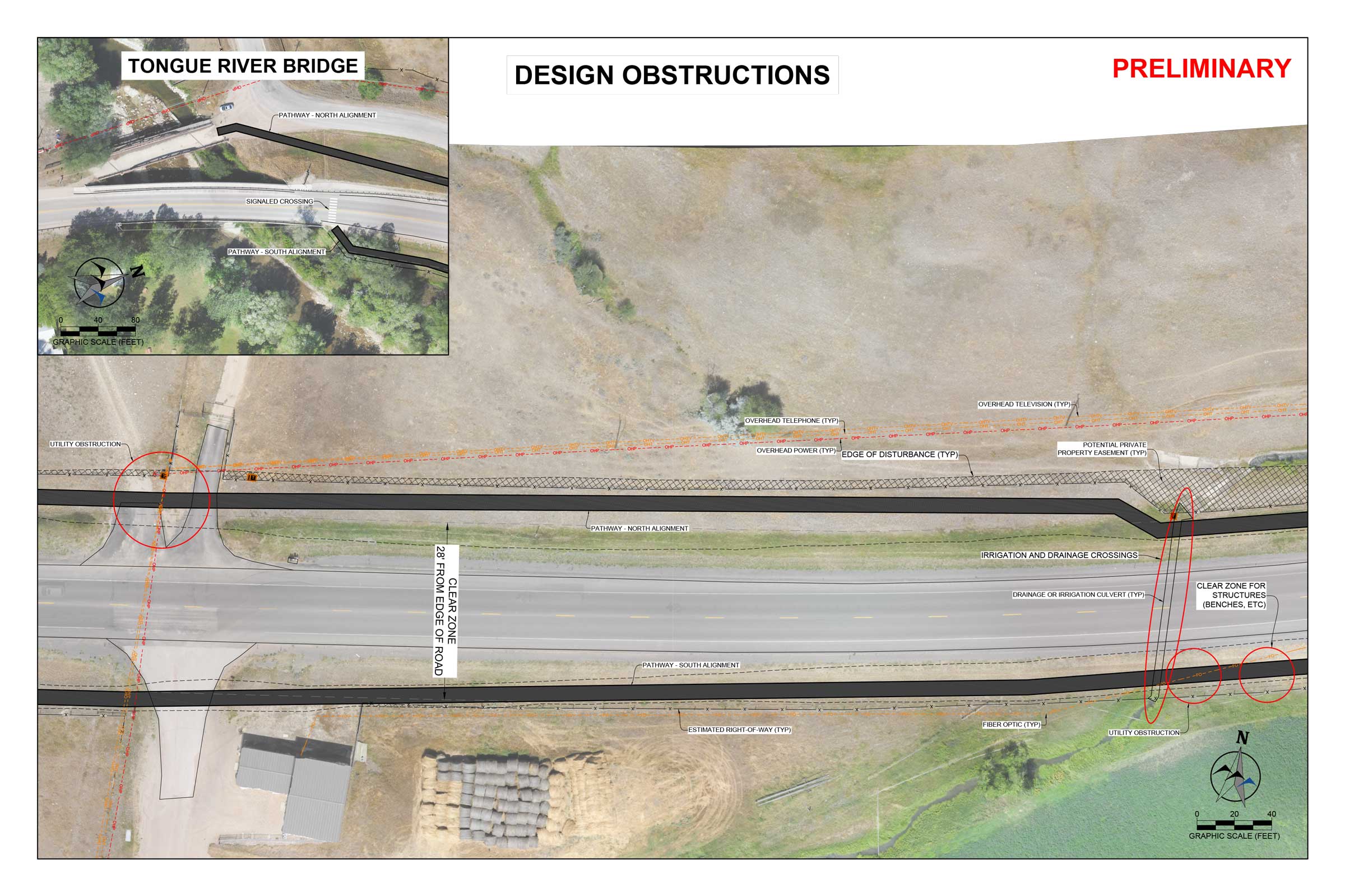
Preliminary Design Considerations
- Utilities
- Pathway close to highway to utilize existing right of way
- Irrigation crossings
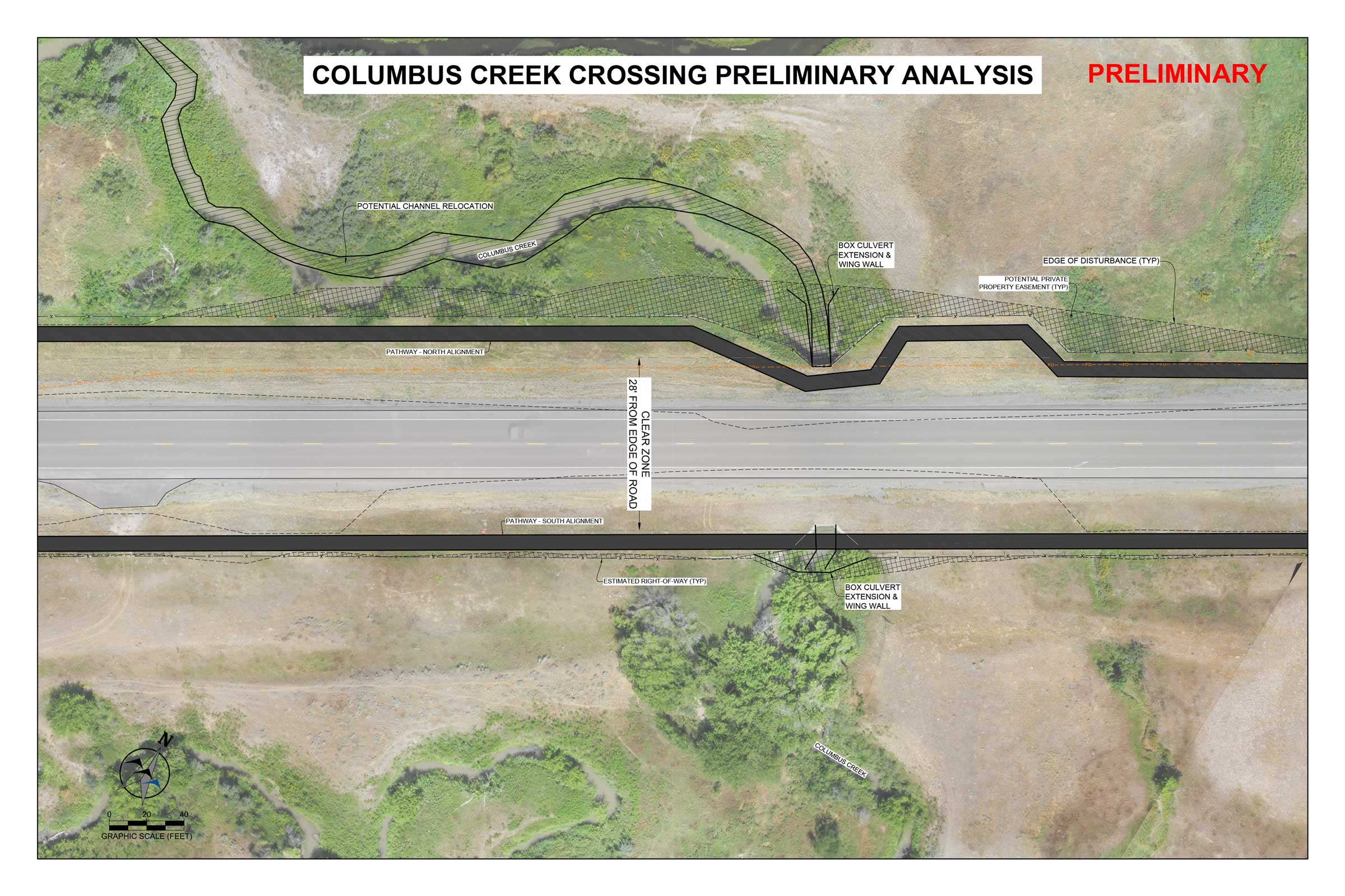
- Columbus Creek crossing
- Steep slopes
- Driveway approaches
- Potential pedestrian street crossings
(Click images to enlarge)
North Side Considerations

South Side Considerations
Study Timeline
